Last Updated:
US Winter Storm Weather Update: Winter has wreaked havoc in America at this time. A fierce storm that hit here recently put half the population in a lockdown-like situation. People were just beginning to recover when another disaster of nature was moving towards superpower.
 Ready to wreak havoc. (Credit- Reuters)
Another Winter Storm to Hit US: America may be setting world politics on fire at the moment, but this country itself has been frozen by a cold crisis. Due to the snow storm, there is already a state of emergency in 18 states of America. Due to snowfall, everything from travel to basic facilities was affected. Even in the most advanced country of the world, people had to live without electricity. Although the situation was gradually improving, yet another disaster awaits America.
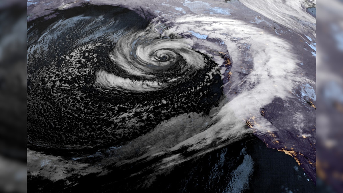
In fact, the possibility of a powerful winter storm hitting the East Coast of America is increasing. According to meteorologists, this storm will form near the Carolina coast at the end of this week. Although it is not yet clear to what extent the storm will affect and what kind of snow will fall, but because of its strength it is being called a bomb cyclone.
How will a bomb cyclone be formed?
Weather models as of Tuesday suggest a system will form near the Carolina coast early Saturday.
It can rapidly become stronger and become a ‘bomb cyclone’. However, the path of the storm has not been decided yet. Yet a difference of just 100–200 miles can decide whether heavy snow will fall in America’s major cities or melting will be felt only due to cold air.
Will the storm cause devastation like a snowstorm?
This storm will be in less area than the snow storm but it is expected to be more powerful and dangerous. A blizzard-like situation may also occur along with snow. However, like a winter storm, there is less possibility of freezing rain. During storms, high waves can occur on beaches and erosion can occur.

A demon growing in the bosom of the sea. (Credit- Reuters)
Under which 3 circumstances can a bomb cyclone be seen?
First condition – cold winds and snowfall
This means that the impact of this storm will be limited to the coast. The storm will come close to the coast and then move towards the sea. This could cause heavy snow and strong winds in coastal areas from Cape Hatteras in North Carolina to Cape Cod in Massachusetts. Eastern North Carolina is expected to be most affected by this, while big cities like the capital Washington DC, New York and Boston may narrowly escape.
Second scenario – widespread snowfall
It is believed that the storm will move close to the coast. Heavy snow may occur from the Carolinas to the I-95 corridor. The impact on areas suffering from previous snowfall and power crisis will increase further. Although this possibility is less but it cannot be completely ruled out.
Third situation – very little impact
A weather model is also saying that the storm may move straight into the sea. Most areas, including Carolina, remain safe and strong winds along with snow are limited to the ocean.
About the Author

Working on International Desk in News18. Also has experience in TV journalism and before that worked for Zee Media Ltd. Worked in. Have knowledge of digital video production. During TV journalism, along with art and literature,…read more